Thursday, January 20, 2011

The Salton Sea Revealed

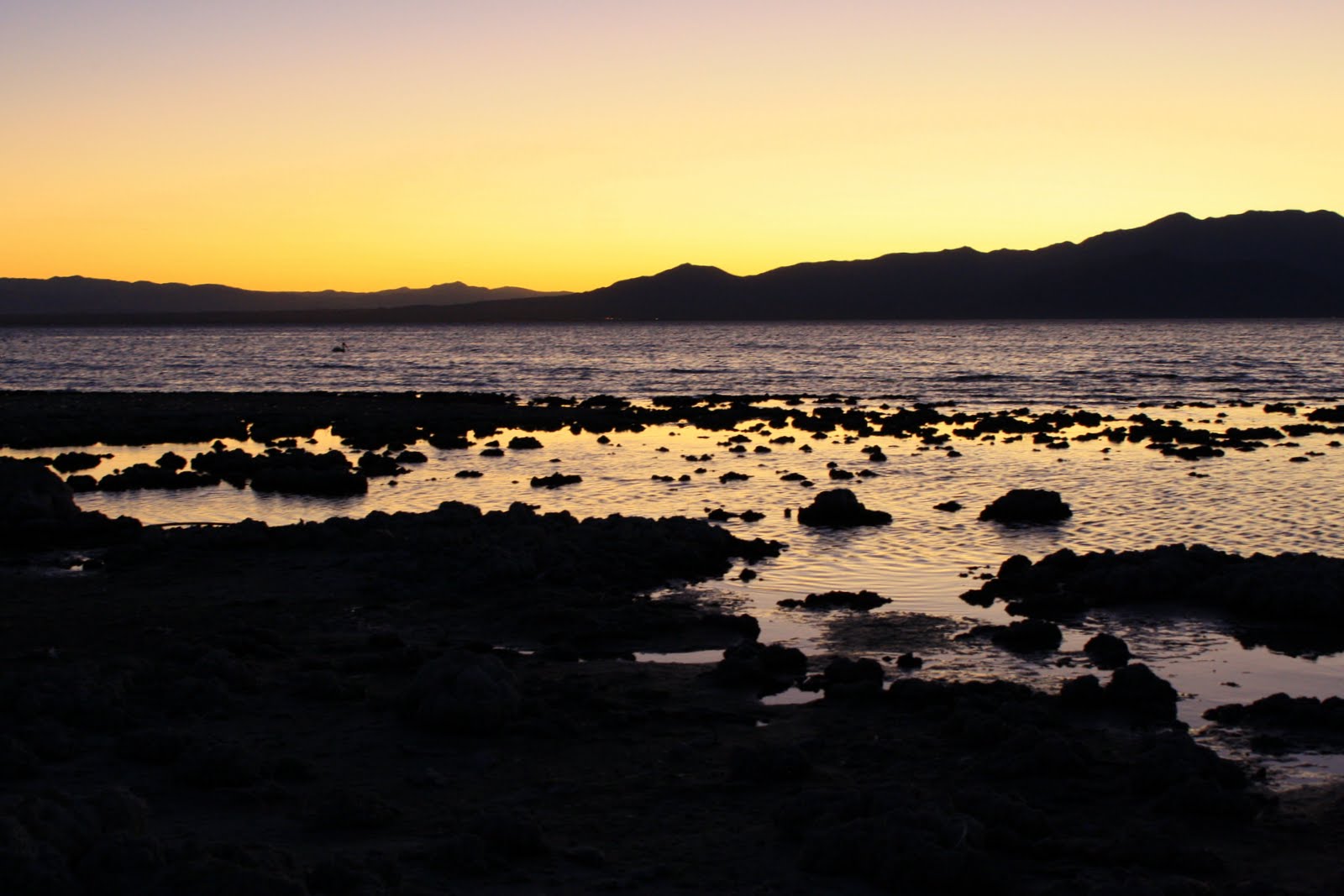
We needed to get away, some place simple and warm - I started driving my Tacoma away from the ocean towards California’s Imperial Valley. I was looking for a certain place but it would have to wait till tomorrow, the sun was going down and my baby's mama was getting hungry. We'd ended up near the east shore of the Salton Sea, the 1st stop on our adventure was Bombay Beach for some sunset pics.

Bombay Beach
Here we first saw up close why, when Hollywood's looking to exemplify the world 50 or 100 years after humanity, they shoot here. The building remains were broken down and encrusted with salt, the entire place had an air of "after" - something I describe when it doesn't seem like anything is happening anymore, the world had just moved on. We were enjoying a spectacular sunset in a place that seemed to once be, but what? We continued up the road still searching for a place we could park the truck for an evening under the stars.

The Salton Sea, two times larger than Lake Tahoe, is one of the world's largest inland seas and lowest spots on earth at -227 below sea level. It was re-created in 1905 when high spring flooding on the Colorado River crashed the canal gates leading into the developing Imperial Valley.  For the next 18 months the entire volume of the Colorado River rushed downward into the "Salton Trough".  By the time engineers were finally able to stop the breaching water in 1907, the Salton Sea had been born at 45 miles long and 20 miles wide equaling about 130 miles of shoreline. 

We entered the Salton Sea State Recreation Area, which covered a good chunk of the eastern shore. Finding Salt Creek we parked the truck on a flat spot for our nights slumber. As my wife took some final twilight shots she made a discovery. 
"Uh, honey? Can you come over here please... quickly?" 

She had found a blanket of dead fish covering the shoreline as far as we could see in the waning light...
What the hell was going on around here? Some research revealed an article claiming 7.6 million fish had died in August, washing up on shore for days after.

The accepted scientific explanation of this summer fish die-off involves several oxygen-depleting factors starting with the combination of sun and salt: Salt water carries less oxygen than fresh water, and hot water carries less oxygen than cool water.


Credit 

Jacques Descloitres, MODIS Rapid Response Team, NASA/GSFC
Agricultural run-off from the Imperial, Coachella, and Mexicali Valleys supplies 90 percent of the inflow to the Sea. When summer winds churn up rich nutrients like phosphates and nitrates, plants and algae bloom, sometimes turning an entire end of the lake green within a day. 

When the sea's increasingly briny water heats up in summer temperatures that can reach 125 degrees, and the decaying algae also consumes more of the water's oxygen - the tilapia begin to suffocate, and die by the millions.


1960's North Shore Yacht Club
Apparently after the 1905 "mistake" fisherman noticed the rapidly increasing salinity of the new sea, imported marine fish from the Pacific Ocean and turned the Salton Sea into one of the best sport fishing locations in the United States. So by the 1950’s this "mistake" had turned itself into a thriving success, its salinity and below sea level altitude made it ideal for water sports. The area also became a world famous bird watching location, due to its critical location on the Pacific Migratory Flyway.  Fifty years after its creation, the Salton Sea was a premier working class vacationers’ destination, attracting more visitors per year than Yosemite National Park.
We were appalled and amazed, it was gross and weird and we weren't afraid. I mean, they were long dead, dried up & we couldn't actually see anything in the dark. The off-shore breeze felt nice as we laid down for the night.
Slab City Library

The next morning that breeze had stopped and we realized why we had so few neighbors, some of these fish were still decomposing! The smell was our first clue, so we packed camp and got back on the road motivated to explore this alien landscape to the fullest, we were searching for Salvation Mountain. I had read about this place in Jon Krakauers biography of Chris McCandless "Into the Wild", and after some research found out it really exists.

Salvation Mountain

Inside Salvation Mountain
Slab City (near Niland, CA, at the eastern edge of the Salton Sea) – So named because of the cracked concrete slabs still remaining from a World War II military base, this remains one of the last “free spaces” in America. Every winter, thousands of “snow birds” migrate to this desert site for un-patrolled, fee-free camping. Every parched, kiln-hot summer, they depart – except for a hard-core group of about 150 full-timers, including folk artist Leonard Knight, whose nutty Salvation Mountain clay-and-plaster art project has been going strong for years.
We explored the acrylic ongoing masterpiece and drove around this desert village, it was fascinating, I had never seen organized homesteading and was actually feeling a little proud to be an American knowing that there still are places a man can just claim as his own.

Homestead

We drove north back along the sea having decided to sleep near a vista spot within Anza-Borrego beyond the western shore that evening. Our intent was to explore the Salton shoreline around the northern edge till our road broke west into the higher desert.

The city of Salton existed where the sea now resides, over 100 years ago it was evacuated, flooded and replaced by Salton City on the western shoreline. We pulled in and began to see street after developed street, empty lots for miles all strung with power lines and underground cable, we kept driving towards the water amazed at this "almost" community.

We had to know the rest of the story, what happened that made everyone go away? Who planned to build so much and never did?


During that 1950's boom promoters had started building hotels, yacht clubs, and the infrastructure for a huge resort city. Celebrities such as Sonny Bono, Frank Sinatra and the Beach Boys started coming to the area and the abundant future of the Salton Sea economy seemed secure.

However, through a curious combination of circumstance and a series of unfortunate events, that plan never materialized.  First was a miscalculation by those promoters: while many lots were sold, few homes were built, as most buyers had purchased their lots for speculative investment or for future retirement.  Next, a series of hurricanes swept through the area: because the Salton Sea has no natural outlet  it is essentially a huge puddle, which rises and recedes dramatically depending on the amount of precipitation in a particular year.  These hurricanes brought tremendous floods whose onslaught submerged yacht clubs, the boat ramps and shoreline properties.

It had rained heavily this year, but I wasn't aware that was a factor we needed to be concerned with. We wanted to see where the desert met the sea, so we continued on aware of the deteriorating road conditions but unaware of its meaning. This area is unique, known to have a salty crust over muddy sand appearing to be dry ground, most locals know to beware.


We stuck the truck near a significant wash and spent the next four hours figuring out how to extract my 4x4 from the Salton Sludge. The locals had come up with an expensive solution: $400 later a modified Snow Cat Tractor pulled me 100 yards to dry ground.


Once free it was time to go home, my poor truck was covered in salty sludge and there was no car wash in sight - the mud was so thick on my axles I had to stay slow, the truck was shaking violently with all the extra weight underneath.


Once through the desert we were up in the mountain town of Julian for some BBQ & apple pie, comfort food in a familiar village. Home wasn't far, and I'll make sure to have better tires, a 4x4 buddy and perhaps a winch the next time I'm that close to the Salton Sea.

Friday, December 10, 2010

Off the Path: A 2nd Cali Matterhorn Attempt


It started out like any other trip, but with a twist, we had been here once before on a therapy/recon mission last October. It started out pretty basic that time, we were looking for a place to go that neither of us had been to - after staring at a map for a few minutes it came to me, why not retrace the steps of Jack Kerouac from the 1958 novel "The Dharma Bums"? I remembered reading about a certain summit in the California Sierra's, the Matterhorn, and had longed to venture into that same apparently inspirational wilderness ever since.
Incredibly Tame Deer
Click for a Full Slideshow from 2009

So, we lit out from Reno early one fall afternoon driving a few hours south on the 395 to the town of Bridgeport, and turned up into the Eastern Sierra about 15 more miles to Twin Lakes parking for the trailhead at the Mono Village Resort. We didn't have much, this trip was meant to be basic… Kerouac had done it in the 50's with minimal food and sneakers. We spent the afternoon lazily trudging up the path enjoying the almost tame wildlife, we had no real goal just get out of town and relax in the wilderness, but as the sun went down the wind picked up and we decided to find some shelter rather than pass out under the stars. (We hadn't brought a tent.) We found a nice cave perfect for the two of us and tarped up the end to keep most of the wind out, Zach & I learned how to rough it together back in the day and have no problem improvising when the situation calls for it.
Fall Aspen, White & Pine

The next morning we awoke to the winter seasons first snowfall, it was a beautiful sight seeing the aspens gold mixed with the white and pine. We decided we had gone far enough due to our rations and my mesh footwear, and retreated back to the lakes amidst the dense yet softly falling large flakes, a perfect mascot for this gentle early storm.

The Cave
That was then, this is now, we're starting from San Diego. After nine hours in the truck we stocked up on some last minute supplies in Bridgeport, made our way back into the Sierra and paid the $10 parking fee for the resort. This time we were prepared, plenty of cold weather gear, proper footwear and food for three days.

We had done our research as well, although finding beta for this particular climb had not proven easy… I hadn't found our actual trail on any maps and it seemed most attempts were from the South side. The Matterhorn, a member of the Sawtooth Range, was part of the Northeastern border between Yosemite Nat'l Park and the Humboldt-Toiyabe Nat'l Forest. We had a Tom Harrison map of the area, it had been enough for us to identify the trails on our previous mission so that would be our guide once on we got started. I'd also been reacquainted by supertopo.com, this sites High Sierra information proved that this mountain was not only real, the North Arete (5.7) was now a regular destination for rock climbers. How tough could it be? Gary Snyder lead Kerouac, an inexperienced outdoorsman, up this summit without any special gear over 50 years ago.

Day 1 Start, Already losing Light
We finished packing & got on the trail, it's always such a nice feeling at the beginning of a hike, the smell of the woods and the sound of the creek, calm and keep me focused on the upcoming climb. We reminisced about how we had mistaken the trail on our last trip, catching the ways we'd been thrown off course before and choosing the other way this time around. After about 20 minutes on a trail that was not ascending as much as we remembered I went up the hill (off trail) to hopefully intersect our intended path, it wasn't there, we had been on a separate path that paralleled the lake. Zach turned around and I proceeded to bushwhack-traverse about 20 minutes back across the steep hill till I eventually was back on the trail, pausing for a few minutes to wait for Zach. Once again the universe has spoken, never underestimate, stay focused.


 Once back together we made great time up the Horse Creek Trail switchbacks taking moments once and a while to snap shots of the shrinking lakes and surrounding solitude. It leveled off towards the first valley where you cross into the Hoover Wilderness and the daylight was dwindling, we were making great time since the sun wasn't heating us up and the mosquitoes would only attack if we stood still. We passed the cave, our refuge from last time, and continued past a nice patch of woods which was our original goal… we were feeling so good and energized we figured why not make it to the spot JK mentions at the end of the boulder field, "A dreamy meadow, pines at one end, the pond, the clear fresh air…" - we knew it was up there, and the climbing guide recommended if we were camping we should stay there - this was about the time my friend, and longest camping partner, realized the map was no longer in his pocket.


“Pretty soon we got to the top of the part of
the trail that was a trail no more...” -J. Kerouac
 Neither of us seemed to care that much, we'd both studied Google earth and that actual map so much it seemed we had things under control. Lots of things went through my head, there were quite a few cars in the lot I thought maybe we'd run into another party. Or, perhaps a nice hiker would find it and see us on the trail the next morning, anyway we'd come too far and knew that we would have a great time with or without a map.

Beyond our intended 1st nights site begins that famed boulder field, where Japhy Ryder taught his wilderness protege about "ducks," the trail indicators, stacks of rocks placed on top of certain boulders by other climbers to keep one going in the correct direction. We headed into the darkness following the ducks up and away from the creek, and the uphill became more challenging. We knew the general direction, up, but could not see the landmarks we were aiming for. Our desire and enthusiasm overtook our skepticism & logic, we missed the crucial right turn that would have lead us towards our goal.

Here's a pic we took on our way out, as you can see the "ducks" on the rock (bottom right) indicate the turn, but a path does keep going up for a bit. We spent about ten minutes building a wall and stacking more ducks to hopefully help us the next time we come up in the dark.

Our mistake
Up we went, convincing ourselves that we were still seeing the ducks every few yards, I was leading the way with Zach's encouragement. We were leaping from large boulder to large boulder through a scree field, up a 45º slope at night, with a headlamp and full pack… I started to doubt our ascent but continued on since I'd just made out some solid vertical rock not far ahead… we were hoping for a place to pitch our tent till the morning came, or at least get a view from. After about 20 minutes of scrambling between snow & rock I'd found no suitable camp, we continued up along the cliff. We found another refuge, this one was useable but not very comfy, and we were nowhere near water (we weren't out but didn't want to start rationing already).

Being near water, although it has the tendency to breed bugs, is usually a happy place to bed down for a night. The trail itself, until we took off on our own, usually stays near the creek. We could still hear it flowing down below, and I was tired of this climbing. Originally we'd figured "get the uphill out of the way as much as we can tonight, sleep in tomorrow." but now we were looking for comfort, and safety. It was pitch black, the moon had set. 

We climbed a bit farther and the rock, although getting more solid, was also getting steeper and not helping our cause, we took a chance...

I stepped away from the cliff and onto the scree, immediately sliding down a few inches. 
Scree field we crossed the 1st Night
I found my balance, and took another step, I was making ground. I wasn't heading back, the idea of going down that slope was not pleasant, damn near scary, so now I'm heading up the valley and the sound of the gurgling stream was getting closer. I made sure Zach was cool, which he was, and sped up taking large sliding steps across & downhill in the fashion JK described when Japhy was bounding down from the summit.

We came to the east bank just below a snow patch and continued up the creek and above the creek (at times the water would run below the rocks that were the trail) till a slippery looking cascade blocked our path, there were trees up there and what we hoped was a lake :) After a few more minutes we discovered a small pond and searched for a place to put our tent… we were starving so once the site was determined we made some tea & campers meals. After relaxing for a bit I retired into the comfort of my sleeping bag for the night.

Reflections, Zach Lyon
The next day we woke up to a beautiful morning, and I found my way to a rise overlooking the valley we had traveled through the night before for some mild yoga. I later found out Zach had awoken and taken some pictures of sunrise.  The skies were clear and the wind had picked up a little, our plan was to leave the overnight gear behind in the tent and take day packs with our fishing gear to the summit.
Morning Do, Zach Lyon


We had some oatmeal with fruit and started uphill, meandering with the stream looking for any life indicating the possibility of the alpine trout lunch we were hoping for… there was none, we kept hiking up eventually joining the trail. Once again we were graced with the surreal experience of walking over the creek, the glacial melt was strong and although we could hear the flowing below us it was rare we could peak through and actually see it.

Basecamp
Eventually we came to the joining of two valleys directly below what we hoped was the Matterhorn, and what seemed like the last alpine "lake" with any depth. I dropped my line in and after about 15 minutes gave up since I hadn't gotten even the tinniest nibble. When I stood up my camera fell into the pool, I fished it out of 12 inches of water after about 10 seconds and immediately extended the lens and emptied the removable parts from the chassis. Zach advised that I tie it to my pack, in the dry air with a little jostling in the sunshine who knows, maybe it will work again.  I was happy he had his camera to back my dumb ass up.
"There is no way I'm dragging
anyone up that without gear."
An hour later it started working again, Canon PowerShot SD750 takes a lickin' and keeps on clickin' (I can't help myself).

On the Glacier
We continued up the ridge surveying the "Matterhorn" from every perspective, it seemed hopeless without gear to try it from the North or East, we were hoping that once we hiked up the valley glacier there might be an easy way up… if that didn't work we would continue up the valley till the end and hopefully find a path to the ridge top which could lead us back around to the Matterhorn. Our fingers were crossed, I stayed on the rocks on the edge of the glacier and Zach used his traction enhancers (YakTrax) and walked on the year round ice. We got quite a ways away from each other, the reality of how big what we were attempting to tackle was setting in, I could still see him but he seemed so small & far away while the mountain loomed even larger & further behind him.
Entering the Glacier (Paths)

Additionally we were walking on this magnificent melting ice block, and enjoying the various features that are part of the summer melt. I was careful not to get too far away from the rock just in case a crevasse was hidden under the crust. This time we could easily see the naturally formed ice luge's running fast with the rapid melt, rocks would fall and carve their path in the surface giving my feet something on the snow to grip.

4th class approach
to Yabyum Chute
The most amazing part of all, huge, more flat than round boulders from who knows how long ago had tumbled onto the white field from the valley walls and as the snow would melt underneath and around them it would create a pedestal supporting this table above the snow.

Rocks on Melting Pedastals


After about an hour we neared the end of the valley and met for some lunch, I had been surveying the upcoming terrain and decided a certain chute looked passable with a little patience and a lot of perseverance, we made our way to the base of the wall and started climbing…
Our Path: "The Yabyum Chute"
Unstable is one word I'm using to describe the area, slippery, rough, delicate and unpredictably harmonious are a few others. Every rock, pebble and grain of earth was balanced in such a perfect way that would sometimes allow our passage, and other times just disintegrate beneath or grip.

I kept climbing, he paid close attention for falling rock, we had "tested" a larger boulder and found out how easy starting a rock slide could be. Rather than wait he found a more comfortable path the next chute over. After some more traversing and climbing up the valley wall we joined up and debated our situation, going down seemed as crazy as continuing, and going up seemed hopeless.
Test Results:
Rock stability = Fail
Zach's reflexes = Pass, and then some

I asked him to let me survey one last route, he obliged and I soloed about 50 feet of loose sharp red vertical rock, it was the hardest unprotected climbing I'd done, the fall would take me on scree to the bottom IF I could stay upright. Zach's words to me as I was cresting the vertical section, "Today's not a good day to die," made up my mind, he was right, if this didn't prove worth while it was time to retreat as safely as possible. When I looked around the rock I saw a reasonable path angling towards the summit field - we were almost to the top of the ridge!
2nd pitch, 5.5 Solo
4th pitch, 5.7 Solo
I conveyed what I'd discovered and he proceeded up the same vertical insanity, made it with no problems and we both carefully finished the "Yabyum Chute" ascent together… we were elated to be so close when just 20 minutes prior we had almost backed down. Continuing up the rock field we found ourselves standing at the head of the valley on a summit similar looking to the Matterhorn but clearly not the top, there was a higher summit along the ridge to the northwest.
Crux

Original Summit Log,
July 12, 1964
We snapped a few shots and continued on, it was after 6pm and we weren't positive of our way down… yet we were determined. Down the ridge and back up around more snow and to the next summit, and once again we felt diminished next to the next summit on the ridge, which was even closer. We scrambled over just to realize that the last one was the highest of all, so back we went and I scoured the area for the summit log. I found it amidst the rocks in a thick aluminum can, the first entry was from 1964 and had been placed by the Sierra Club, we were proud to scribble our names alongside the recreation pioneers from almost 50 years ago… until we read the cover.

Looking West
We had climbed Twin Peaks, 12,323 feet above sea level, the higher of it's more significant twin to the Northwest, Matterhorn Peak, 12,279 feet.
The Matterhorn, from Twin Peaks

Right.

Spiller Creek Canyon,
from Twin Peaks Summit
What. Really?

I dug deeper into the tired old journal and found more entries, In 2007 Anne & Dean from Modesto wrote "Thought we were climbing the Matterhorn, oh well, beautiful view!" and in 2004 the Lehman's from Tucson, "Twin Peaks? So where's the Matterhorn? Hell of a trail, gorgeous day."

Whatever, we have no map so we decided to sort this shit out back in civilization. We had just worked our asses off and still had no idea how to climb that mountain, damn Kerouac for not including better directions and maybe a map in his masterpiece.

Jumping between the rocks
No way seemed logical back to camp, and we needed to get there since we only had day rations and attire with us. Of course we had headlamps but we weren't ready for an overnight. I had studied the map and was still going on the idea that dropping down off of the ridge would bring us into our valley. Every way down we scouted had too much snow and potential cliffs, even the one we had come up. We wandered across "It-Doesn't-Matterhorn Ridge" past that spot and found potential a few chutes over. It seemed to have a snow-soft landing connected to a trail at the bottom leading in the direction we were heading, and no visible drop-offs :| OK then, my words to Zach, "If you have a better idea I'm all ears." He understood, we both did, it was getting dark and if we had any hope to get back tonight we needed to move, and down was at least progress.

As the sun continues to set,
we race across this ridge
hoping for an easy way down.
(courtesy Zach Lyon)
Coming Down
I started sliding down the scree on my ass, Zach chose a different path a bit over from me and we both took our time sliding down the "Seren Dip," aptly named since we considered our success a fortunate accident.

We arrived at the top of the snow pack and still had quite a long way to go. Zach chose the snow path with his fancy YakTrax, which he later mentioned didn't help very much. I only trust rock and found my protection by holding the cliff along the glaciers ledge - it was cold and wet but reassuring to have that handrail helping out.
Sometimes you get that perfect angle
The Seren Dip is Steep
Once to the bottom of the white stuff the darkness had set in and I couldn't see below to our exit - I wasn't sure if this chute was actually going to bottom out or turn into a cliff… I hate dusk, it always plays tricks on the eyes. I needed to see down, I looked over and like a Jenga game, pulled that one piece that set the entire slope moving - I was safe on the bedrock - after a minute or so the dust settled and because it was now brown from dirt I could see our slope gradually become that safe snowy field at the bottom I'd originally seen.

Pink & Snow
We continued down along the rock until the snow became navigable and started towards the trail, it was over yet another boulder field. We followed that path in the snow until it dropped down east of our destination towards Cattle Creek, the canyon next to ours.

Found the Trail we
saw from the Summit
It's now pitch black, and the cold was starting to set in. We were still physically fine but stayed humble, we pushed forward and continued curving west along the descending ridge line. This went on for an hour at least, every time we would crest another ridge we hoped to see our valley, instead we saw more fields of boulders via the freshly risen moon.

Moonrise over the Sawtooths, Zach Lyon
I think to the untrained eye this situation would look pretty bleak, but with a little extra light from Mother Nature I started to see the good around us. I had plenty of food, an extra bottle of water and an emergency blanket - I could find a shelter if I got tired and wait till it got light. I hadn't seen anyone but my buddy for 2 days and I was in the middle of High Sierra Splendor, I just kept vigilant against loose rock when moving and enjoyed the cool fresh air. I'm not sure when I'll be this far from anything again, and I was enjoying it.

Zach had wet boots, minimal warm clothes and dwindling water, (of course I would have shared) - if need be we could make a fire, but he was set on making it back that night. I agreed but had a bad feeling about our final descent, remember that scree field we dealt with the night before? Well this morning I'd examined that area and discovered that most of that scree was broken off from steep cliffs lining that entire eastern side of our valley. He maintained confidence, and I followed content with his belief, we crested our 3rd rise and knew our valley was below... we just weren't sure where in the valley we were over, or what was below.

Trees are a good sign, they need soil to grow and soil can be hard to come by in steep rocky areas. Larger trees need a plentiful water supply to thrive so it was very reassuring to see a few big trees below us on the slope - trees can also indicate that the terrain has additional features like brush or logs, all of which can help you regain your stability in an accidental situation which thankfully never happened. Zach sniffed our way down the grade till we hit some scree, and I jumped in for a nice slide since we'd just determined the floor was in site and our next stop was water.

These trees seemed familiar, the entire valley felt right, I remembered taking that ridge line after I dropped my camera... this was the slope that had been on my left, I was very excited, when we hit the bottom I dunked my head in the creek and drank that fresh glacial melt straight from the tap, we had made it... our tent could be an hour down but we'd recognized some skinny cascades and knew the hard part was done.
Twin Lakes

We made it back to camp too exhausted to do anything but remove our boots and toast our success. We'd toted some Crown Royal up the path, it had been a very long day and it was time to relax under the stars. The next morning we slowly packed our gear and found our way down the trail, paying close attention to each and every feature of the valley walls verifying things we had only guessed at in the dark.

Hiking in the dark raises awareness, but should be approached with caution. We were forced to use memory, logic & instinct to navigate this area and although we still haven't stood on the California Matterhorn, losing oneself in the High Sierra promises adventure every time.


Zach's parting words, "That mountain's not going anywhere man, we'll do it next year." 

I wonder if I can wait that long.

Below is the full slideshow, click to view full size versions with Google map locations.


Video & Editing, courtesy Zach Lyon | Music: Fearless, by Pink Floyd


Sunday, October 31, 2010

A Long Travel Day to Crete

Here we go, the final chapters of “Living the Dream”, or LTD as we’ve nicknamed it. I discussed the origin of this abbreviation with my closest friends, since it was with them that I originally coined the phrase. One insisted that he brought it with him from a friend who used to state it back home, the other thinks he may have come up with it... I’ve said it before, damn my twenties and all of the lost memories! I don’t think we’ll ever truly remember exactly where it came from, but one thing stands true: I owned it for myself, this blog being an extension of me, and have now publicized it as my own creation since I was in fact living my dream - whilst before my cohorts and I would just visit it on vacations from our daily grind. What’s amazing is that so many others out there utilize the phrase for themselves, including the abbreviation. Within the Twitter world #LTD has been trending for years, and probably will be forever. Google it and you’ll find it’s not just a popular blog title, people use it to describe their fantasies around the world. The best creations are usually taken which just reiterates how great of an idea it is in the first place, c’est la vie. I’ll never stop living my dreams individually, but I have stopped living it constantly which is why these final chapters have been so hard for me to write. In a way I’m putting my childish obsession to bed for hopefully someday my own son to awaken, and realize he himself can do whatever he puts his heart to. I’m now taking on a new challenge, a purpose other than make money and have fun. I’m living a life that has so far been an adventure, and I think will be one constant state of discovery for the rest of my days; Fatherhood: Our son is due to arrive sometime in May, roughly two months from now, and although I’ve been procrastinating finishing this project since returning from our honeymoon in August it’s time I do so. I don’t foresee myself all that concerned with this former life of mine once Junior arrives, and I’m guessing my inspiration will be towards new goals for self satisfaction.

Returning Scooterini

I left off with our last day on Santorini, it was simply supposed to entail us traveling from our Villa back to the port, jumping on a ferry to Heraklion, Crete, and finding our way to an all-inclusive resort on the Libyan Sea. The day started with my wonderful new wife bringing me breakfast in bed, exactly the motivation I needed to finish our packing. She had enlisted the help of our hotel to get her back to the port, while I strapped on as many bags as I could fit onto the scooter for one final ride, it was time to return it. We bode farewell to our friends and I made my way back down to the islands main harbor. I arrived with time to spare and into the ferry office to confirm our tickets.

The truly disappointing part is, I've done this before. Pretty much every country in the world, except the grand ol' U.S of A works in military time... We'd missed our ferry, apparently it left at 1:25 AM, about 10 hours prior, and since we'd missed it our 60 Euros was wasted. I promptly dropped another 100 Euros on a second pair of tickets which would not be departing till 17:55, about seven hours later. I sat down at a cafe awaiting my wife’s arrival, and wondering how we would kill time till our ferry arrived. When Dorothy met me her only disappointment was the lost savings, she had worked hard to find that discount fare and it was all for naught, we grabbed a few beers to take the edge off and pondered our next move. We decided that staying at the port would be the most financially guilt free option, although this was a honeymoon we were still traveling on a budget, a budget we had already seriously gone over with our first move of the day. Leaving the port would cost money, and then returning would cost more money.

Thira Port

The port was was boring, extremely hot and not very scenic - we did our best to make due. Our scooter rental agent agreed to store our bags while we wandered the area looking for shade and observing the various ferries coming and going. Our main focus was to stay out of the sun, and hydrated - we joked about my prior travel errors, the big one being that missed flight to Korea 18 months earlier... a trip I’d packed for weeks prior to eventually making the same mistake between AM & PM. One would think I’d learned a lesson.

The heat was pretty unbearable, so we went to the ports edge where we found a small cave next to the water, and I jumped in. Rinse, repeat, every hour or so we’d wander back to a shop and fill our water bottles... and then back to the cave to cool off. It was the opposite of the dreamlike state we’d been floating in since arriving in Greece, but we didn’t have a choice, and we knew that once we toughed it out we’d have comfy seats on a pretty quick boat to our next island. At least we were able to swim... finally our ferry, the “Flying Cat IV” arrived and we were able to board. This was our first experience with a hi-speed hydrofoil style ferry, and after waiting all day all we wanted to do was get on with our trip.
Flying Cat IV
Getting off of Santorini was just the beginning, we still had some complicated traveling to do since public transportation was not very active at night on Crete. Three hours later we arrived in the capitol city of Heraklion, hustled a few block to the bus station and sorted out our next move. We had to wait just under an hour to catch a bus to Rethymno, an hour ride to the east and only half of the way to Plakias, the closest village to our final destination. We found out some more disappointing news, the next bus servicing that area wasn’t till morning - if we were going to make it to our already paid for resort that night our only hope was to find a taxi. Awesome. We got dropped off at the Rethymno Bus Depot and made our way to what seemed like a cab stand, unfortunately the only taxi we saw was already taken but we still asked him if he could call us another.

Now the story turns around - I knew you were waiting.

He could not in fact enlist the help of a fellow cab driver, we were apparently going way off the beaten path. After a short conversation with his current passengers they obliged that the American honeymooners could join them to their drop-off point which was a short distance, and on the way to ours. We found out our co-passengers were Germans, and after a brief exchange of pleasantries they were dropped off at their hotel and we turned south starting up the ancient volcano/mountain that is Crete. Our driver was taking an obscure path, and we started to realize this guy seemed a little nuts. He was chain smoking cigarettes and driving as fast as possible, I just kept my eyes on my compass verifying we were heading in the right direction. He was taking back roads, which I’m usually a fan of but not necessarily this late at night in completely unfamiliar territory. But whatever, we were getting an OK deal, 30 euros for the one hour ride - and honestly we didn’t have much choice. Twisting, turning, zipping through the smallest villages past countless monasteries and farms, it really was an amazing ride. After 45 minutes he found a few “friends” we guess, hanging out on a porch, so we stopped. He gestured for us to get out, which was shady as hell but we didn’t want to offend and so far, other than some crazy driving, he hadn’t steared us wrong yet.

After Shot #1
His friends had set us up with some chairs, and immediately he retrieved a clear bottle of what we found out was “Especial” - a Greek Liquor, and several shot glasses. The Greeks, as we’re finding out, are tremendous romantics, and celebrate love at any opportunity. So we toasted to our new marriage and did our first of several shots. Our taxi driver then disappeared, and drove the cab out of sight? This freaked me out since our luggage was in the trunk, but apparently he was blocking the road and needed to keep it clear. All of this was getting explained to us by a man name Stafylos, the proprietor of this establishment who spoke near perfect English having attended NYU in his youth. Our driver returned and we probably did three more shots each emptying the “Especial” having toasting to everything from this serendipity, to the weather. And then, just like that, after handshakes from each of the older men, we were off back into the night with our driver bummin’ more smokes from me and seemingly re-energized after the shots.

I know what you’re thinking, and trust me we were too, but we were at his mercy praying that our karma would carry us through this one. He made one more stop, apparently looking for another place to celebrate, this place was almost dark and from what we could tell the inhabitant had recently broken a leg, so we did NOT do any more shots. (We were already pretty buzzed, and sure our driver didn’t need any more) Our ride crested the mountain and began its descent down to the north side of the island towards Plakias. (from this vantage we could see the African coast twinkling in the distance) More winding down crazy guard-rail-less roads high over deep what appeared to be bottomless ravines. About an hour later we took a quick run through the village where his mother ran a gyro shop hoping for some food, but sadly everything was closed for the night, so we went over one more hill finally passing through the gate of the “Kalypso Creten Village” - our home for the next seven days. We paid our driver and thanked him for the perfect end to a long day, checked in, scarfed down our courtesy plate of food (the kitchen had prepared for us knowing we would be arriving after it was closed) and collapsed onto our bed. It was time to end this day, we would explore our first all-inclusive manana.

I’ve opted to share this as it’s own blog post, and apologies for the lack of pictures. As you can guess pulling out the camera was the last thing on our mind most times, we were moving too fast and more concerned with protecting our electronics than actually using them. More to Come!