 |
It started out like any other trip, but with a twist, we had been here once before on a therapy/recon mission last October. It started out pretty basic that time, we were looking for a place to go that neither of us had been to - after staring at a map for a few minutes it came to me, why not retrace the steps of Jack Kerouac from the 1958 novel "The Dharma Bums"? I remembered reading about a certain summit in the California Sierra's, the Matterhorn, and had longed to venture into that same apparently inspirational wilderness ever since.
 |
| Incredibly Tame Deer |
 |
| Click for a Full Slideshow from 2009 |
So, we lit out from Reno early one fall afternoon driving a few hours south on the 395 to the town of Bridgeport, and turned up into the Eastern Sierra about 15 more miles to Twin Lakes parking for the trailhead at the Mono Village Resort. We didn't have much, this trip was meant to be basic… Kerouac had done it in the 50's with minimal food and sneakers. We spent the afternoon lazily trudging up the path enjoying the almost tame wildlife, we had no real goal just get out of town and relax in the wilderness, but as the sun went down the wind picked up and we decided to find some shelter rather than pass out under the stars. (We hadn't brought a tent.) We found a nice cave perfect for the two of us and tarped up the end to keep most of the wind out, Zach & I learned how to rough it together back in the day and have no problem improvising when the situation calls for it.
 |
| Fall Aspen, White & Pine |
The next morning we awoke to the winter seasons first snowfall, it was a beautiful sight seeing the aspens gold mixed with the white and pine. We decided we had gone far enough due to our rations and my mesh footwear, and retreated back to the lakes amidst the dense yet softly falling large flakes, a perfect mascot for this gentle early storm.
 |
| The Cave |
We had done our research as well, although finding beta for this particular climb had not proven easy… I hadn't found our actual trail on any maps and it seemed most attempts were from the South side. The Matterhorn, a member of the Sawtooth Range, was part of the Northeastern border between Yosemite Nat'l Park and the Humboldt-Toiyabe Nat'l Forest. We had a Tom Harrison map of the area, it had been enough for us to identify the trails on our previous mission so that would be our guide once on we got started. I'd also been reacquainted by supertopo.com, this sites High Sierra information proved that this mountain was not only real, the North Arete (5.7) was now a regular destination for rock climbers. How tough could it be? Gary Snyder lead Kerouac, an inexperienced outdoorsman, up this summit without any special gear over 50 years ago.
 |
| Day 1 Start, Already losing Light |
Once back together we made great time up the Horse Creek Trail switchbacks taking moments once and a while to snap shots of the shrinking lakes and surrounding solitude. It leveled off towards the first valley where you cross into the Hoover Wilderness and the daylight was dwindling, we were making great time since the sun wasn't heating us up and the mosquitoes would only attack if we stood still. We passed the cave, our refuge from last time, and continued past a nice patch of woods which was our original goal… we were feeling so good and energized we figured why not make it to the spot JK mentions at the end of the boulder field, "A dreamy meadow, pines at one end, the pond, the clear fresh air…" - we knew it was up there, and the climbing guide recommended if we were camping we should stay there - this was about the time my friend, and longest camping partner, realized the map was no longer in his pocket.
 |
| “Pretty soon we got to the top of the part of the trail that was a trail no more...” -J. Kerouac |
Beyond our intended 1st nights site begins that famed boulder field, where Japhy Ryder taught his wilderness protege about "ducks," the trail indicators, stacks of rocks placed on top of certain boulders by other climbers to keep one going in the correct direction. We headed into the darkness following the ducks up and away from the creek, and the uphill became more challenging. We knew the general direction, up, but could not see the landmarks we were aiming for. Our desire and enthusiasm overtook our skepticism & logic, we missed the crucial right turn that would have lead us towards our goal.
Here's a pic we took on our way out, as you can see the "ducks" on the rock (bottom right) indicate the turn, but a path does keep going up for a bit. We spent about ten minutes building a wall and stacking more ducks to hopefully help us the next time we come up in the dark.
 |
| Our mistake |
Being near water, although it has the tendency to breed bugs, is usually a happy place to bed down for a night. The trail itself, until we took off on our own, usually stays near the creek. We could still hear it flowing down below, and I was tired of this climbing. Originally we'd figured "get the uphill out of the way as much as we can tonight, sleep in tomorrow." but now we were looking for comfort, and safety. It was pitch black, the moon had set.
We climbed a bit farther and the rock, although getting more solid, was also getting steeper and not helping our cause, we took a chance...
I stepped away from the cliff and onto the scree, immediately sliding down a few inches.
 |
| Scree field we crossed the 1st Night |
We came to the east bank just below a snow patch and continued up the creek and above the creek (at times the water would run below the rocks that were the trail) till a slippery looking cascade blocked our path, there were trees up there and what we hoped was a lake :) After a few more minutes we discovered a small pond and searched for a place to put our tent… we were starving so once the site was determined we made some tea & campers meals. After relaxing for a bit I retired into the comfort of my sleeping bag for the night.
 |
| Reflections, Zach Lyon |
 |
| Morning Do, Zach Lyon |
We had some oatmeal with fruit and started uphill, meandering with the stream looking for any life indicating the possibility of the alpine trout lunch we were hoping for… there was none, we kept hiking up eventually joining the trail. Once again we were graced with the surreal experience of walking over the creek, the glacial melt was strong and although we could hear the flowing below us it was rare we could peak through and actually see it.
 |
| Basecamp |
 |
| "There is no way I'm dragging anyone up that without gear." |
 |
| On the Glacier |
 |
| Entering the Glacier (Paths) |
Additionally we were walking on this magnificent melting ice block, and enjoying the various features that are part of the summer melt. I was careful not to get too far away from the rock just in case a crevasse was hidden under the crust. This time we could easily see the naturally formed ice luge's running fast with the rapid melt, rocks would fall and carve their path in the surface giving my feet something on the snow to grip.
 |
| 4th class approach to Yabyum Chute |
 |
| Rocks on Melting Pedastals |
After about an hour we neared the end of the valley and met for some lunch, I had been surveying the upcoming terrain and decided a certain chute looked passable with a little patience and a lot of perseverance, we made our way to the base of the wall and started climbing…
 |
| Our Path: "The Yabyum Chute" |
I kept climbing, he paid close attention for falling rock, we had "tested" a larger boulder and found out how easy starting a rock slide could be. Rather than wait he found a more comfortable path the next chute over. After some more traversing and climbing up the valley wall we joined up and debated our situation, going down seemed as crazy as continuing, and going up seemed hopeless.
 |
| Test Results: Rock stability = Fail Zach's reflexes = Pass, and then some |
I asked him to let me survey one last route, he obliged and I soloed about 50 feet of loose sharp red vertical rock, it was the hardest unprotected climbing I'd done, the fall would take me on scree to the bottom IF I could stay upright. Zach's words to me as I was cresting the vertical section, "Today's not a good day to die," made up my mind, he was right, if this didn't prove worth while it was time to retreat as safely as possible. When I looked around the rock I saw a reasonable path angling towards the summit field - we were almost to the top of the ridge!
 |
| 2nd pitch, 5.5 Solo |
 |
| 4th pitch, 5.7 Solo |
I conveyed what I'd discovered and he proceeded up the same vertical insanity, made it with no problems and we both carefully finished the "Yabyum Chute" ascent together… we were elated to be so close when just 20 minutes prior we had almost backed down. Continuing up the rock field we found ourselves standing at the head of the valley on a summit similar looking to the Matterhorn but clearly not the top, there was a higher summit along the ridge to the northwest.
We snapped a few shots and continued on, it was after 6pm and we weren't positive of our way down… yet we were determined. Down the ridge and back up around more snow and to the next summit, and once again we felt diminished next to the next summit on the ridge, which was even closer. We scrambled over just to realize that the last one was the highest of all, so back we went and I scoured the area for the summit log. I found it amidst the rocks in a thick aluminum can, the first entry was from 1964 and had been placed by the Sierra Club, we were proud to scribble our names alongside the recreation pioneers from almost 50 years ago… until we read the cover.
 |
| Crux |
 |
| Original Summit Log, July 12, 1964 |
 |
| Looking West |
We had climbed Twin Peaks, 12,323 feet above sea level, the higher of it's more significant twin to the Northwest, Matterhorn Peak, 12,279 feet.


I dug deeper into the tired old journal and found more entries, In 2007 Anne & Dean from Modesto wrote "Thought we were climbing the Matterhorn, oh well, beautiful view!" and in 2004 the Lehman's from Tucson, "Twin Peaks? So where's the Matterhorn? Hell of a trail, gorgeous day."
Whatever, we have no map so we decided to sort this shit out back in civilization. We had just worked our asses off and still had no idea how to climb that mountain, damn Kerouac for not including better directions and maybe a map in his masterpiece.
 |
| Jumping between the rocks |
 |
| As the sun continues to set, we race across this ridge hoping for an easy way down. (courtesy Zach Lyon) |
 |
| Coming Down |
We arrived at the top of the snow pack and still had quite a long way to go. Zach chose the snow path with his fancy YakTrax, which he later mentioned didn't help very much. I only trust rock and found my protection by holding the cliff along the glaciers ledge - it was cold and wet but reassuring to have that handrail helping out.
 |
| Sometimes you get that perfect angle |
 |
| The Seren Dip is Steep |
 |
| Pink & Snow |
 |
| Found the Trail we saw from the Summit |
 |
| Moonrise over the Sawtooths, Zach Lyon |
Zach had wet boots, minimal warm clothes and dwindling water, (of course I would have shared) - if need be we could make a fire, but he was set on making it back that night. I agreed but had a bad feeling about our final descent, remember that scree field we dealt with the night before? Well this morning I'd examined that area and discovered that most of that scree was broken off from steep cliffs lining that entire eastern side of our valley. He maintained confidence, and I followed content with his belief, we crested our 3rd rise and knew our valley was below... we just weren't sure where in the valley we were over, or what was below.
Trees are a good sign, they need soil to grow and soil can be hard to come by in steep rocky areas. Larger trees need a plentiful water supply to thrive so it was very reassuring to see a few big trees below us on the slope - trees can also indicate that the terrain has additional features like brush or logs, all of which can help you regain your stability in an accidental situation which thankfully never happened. Zach sniffed our way down the grade till we hit some scree, and I jumped in for a nice slide since we'd just determined the floor was in site and our next stop was water.
These trees seemed familiar, the entire valley felt right, I remembered taking that ridge line after I dropped my camera... this was the slope that had been on my left, I was very excited, when we hit the bottom I dunked my head in the creek and drank that fresh glacial melt straight from the tap, we had made it... our tent could be an hour down but we'd recognized some skinny cascades and knew the hard part was done.
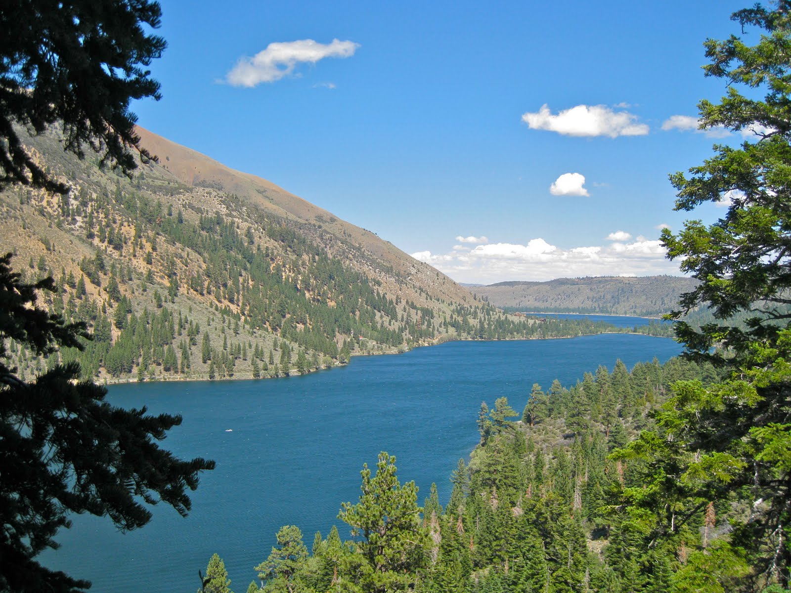 |
| Twin Lakes |
We made it back to camp too exhausted to do anything but remove our boots and toast our success. We'd toted some Crown Royal up the path, it had been a very long day and it was time to relax under the stars. The next morning we slowly packed our gear and found our way down the trail, paying close attention to each and every feature of the valley walls verifying things we had only guessed at in the dark.
Hiking in the dark raises awareness, but should be approached with caution. We were forced to use memory, logic & instinct to navigate this area and although we still haven't stood on the California Matterhorn, losing oneself in the High Sierra promises adventure every time.
Zach's parting words, "That mountain's not going anywhere man, we'll do it next year."
I wonder if I can wait that long.
Below is the full slideshow, click to view full size versions with Google map locations.
Video & Editing, courtesy Zach Lyon | Music: Fearless, by Pink Floyd
